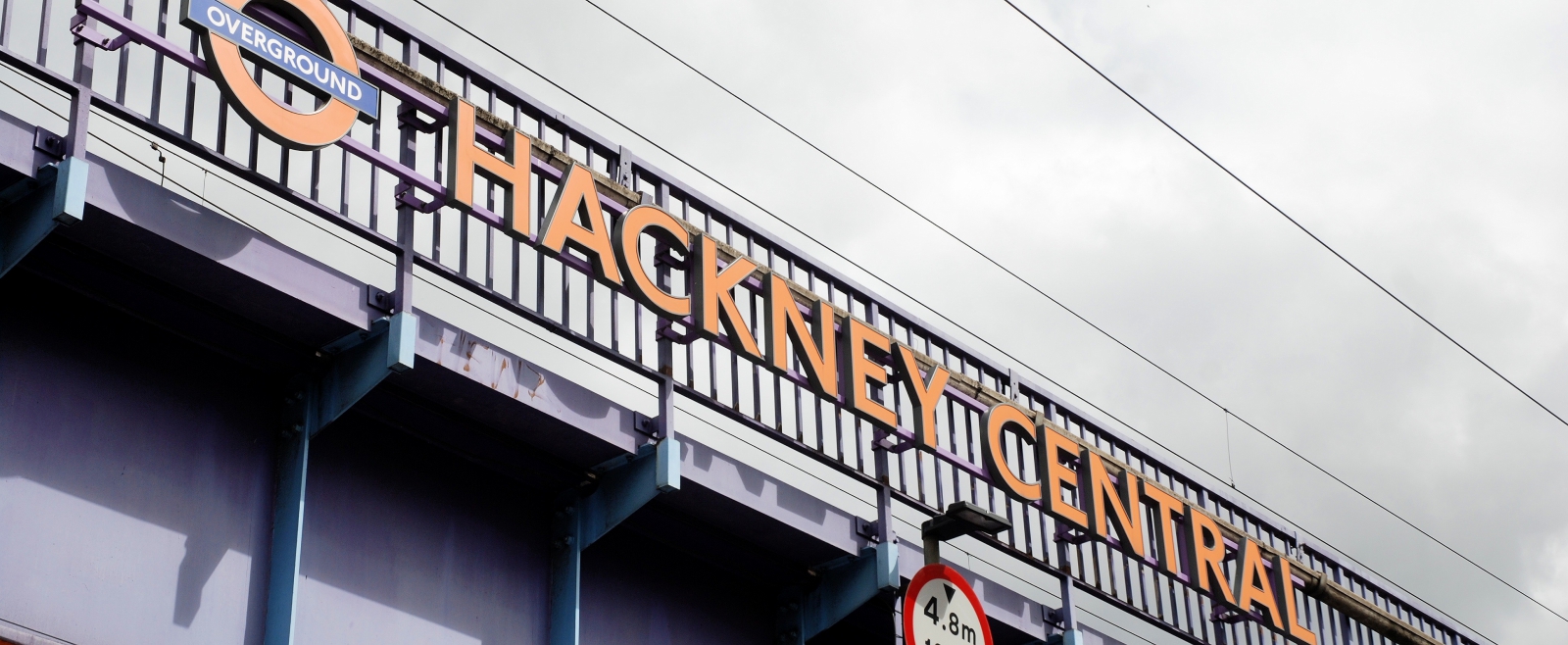
Clapton Area Guide
A locals' guide to Clapton
Where do Clapton locals go?
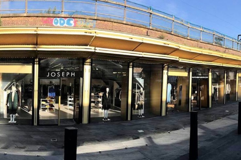
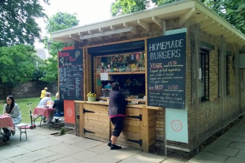
Hackney Walk
The upcoming home for fashion designers. Hackney Walk is a fashion district located within East London. It is a new ultimate luxury shopping experience that consists of many major and luxury designer brands. Hackney Walk is a trendy hub for great urban food, leisure and community activities. It is amazing, as Hackney is such a diverse and energetic area in London!Read more
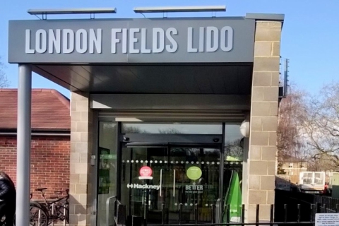
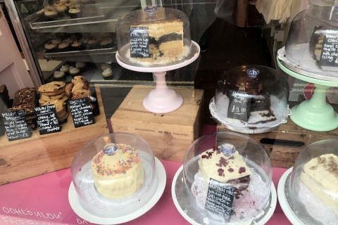
London Fields Lido
Perfect for a fun day out, especially in the summer, this outdoor pool in Hackney's London Fields is one of London's last remaining lidos. It is open all year round and is, of course, heated. Why not grab lunch from either one of their two cafes after an exciting dip?!Read more

Did you know?
"Renowned pioneer of female independence, Hackney born Dorothy Levitt was the holder of both the world water speed record and the ladies land speed record. Her tip for women drivers travelling alone? Carry a revolver!"
Alexandra Lega

Sophie Harries

Chris Ball
Explore Clapton


What locals say about Clapton
“See the Hackney information... open green spaces, walk distance to Olympic park via canal, 2 stops to the Olympic Park and Westfield from Homerton station. Lots of interesting shops and cafes and Sunday market on Chatsworth Rd. The Picture House cinema and The Hackney Empire on Mare Street.”
Local resident
Activities near Clapton

Free Entry Pxssy Pwr Takeover: Jessica Wilde, Ruby Francis, Pantherina
THIS JUNE for 4 Thursdays Oslo are collaborating with different queer collectives for FREE ENTRY shows in our bar. Thursday 12th it's the Pxssy Pwr takeover Line up: Jessica Wilde Ruby Francis Pantherina Having already taken the iconic venue, Hootananny Brixton by storm, with multiple sold out shows and the likes of Etta Bond, Zoe Kypri, Chi and many more incredible women hitting the stage... PxSSY PWR has become a household name, from live shows to radio, clothing lines and festival take overs. Founded by singer, rapper and producer Jessica Wilde, and fronted by her pink wigged, unapologetic and pxssy powerful alter ego Ya Gurl Charlene. PxSSY PWR’s ethos is centred around community and raising the vibrations through the power of music (and PxSSY of course! )... Presented by DHP FAMILY. This is a 18+ event (Photo ID Required.)Read more
Chez Damier
Nt's loft presents. an intimate club + terrace space overlooking the East London skyline. Free table reservations available via our website - subject to availability. Chez Damier takes over the loft booth with a vast record collection including sounds from the golden era of house music and Chicago-tinged contemporary classics. Important ticket information Ticket time requirements must be adhered to. Late arrival will incur a surcharge at the door for entry. This is not guaranteed and subject to capacity. Presented by Night Tales Loft. This is an 18+ event. Bring your ID card with you. ID Scanner in place.Read more

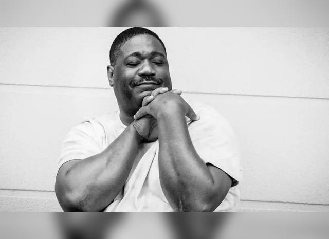
Mohammad Syfkhan
Mohammad’s own brand of ecstatic music takes elements from Middle Eastern and North African music to create an atmosphere of joy, love and happiness. Mohammad Syfkhan is a Kurdish/Syrian Singer and Bouzouki player. He began playing music in 1980 while he was in college studying nursing. When he got his degree in 1983, Mohammad moved to the city of Raqqa, Syria where he began working as a professional singer and started his own band, The Al-Rabie Band which played concerts, parties, weddings and festivals all over Syria. The Al-Rabie Band were a much sought-after group. Their live sets included Kurdish, Arabic, Turkish and some Western songs as well as Mohammad’s own original material. Presented by The Beauty Witch. This is an 18+ eventRead more
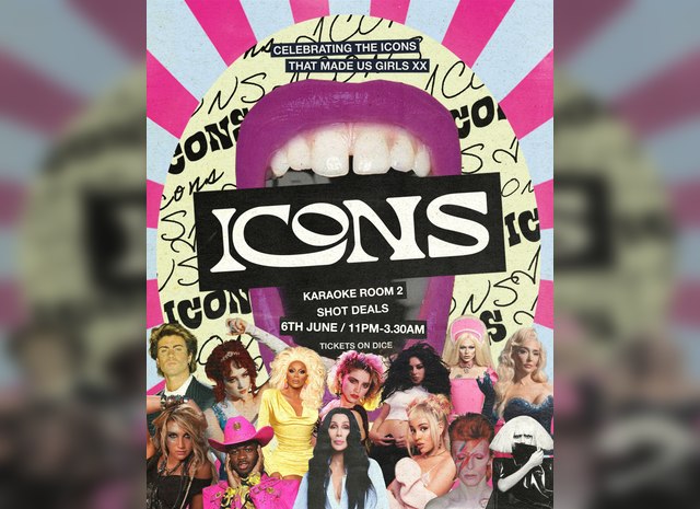
Icons: Celebrating Queer Icons This Pride
A night of bangers from Queer Icons in celebration of Pride month. 2 floors Drag Karaoke Drag Race Best bits Visuals Expect to hear: Ru Paul, Lady Gaga, Bowie, Madonna, Bimini, George Michael, Charli xcx, Chappel Roan, Doja Cat, Erika Jayne, Kesha, Cher, Lil Nas X + MORE Presented by DHP FAMILY. This is a 18+ event (Photo ID Required)Read more
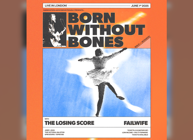
Born Without Bones / The Losing Score / Failwife
Born Without Bones plays their first London Headliner at The Victoria on June 1st, with support from The Losing Score & Failwife. Born Without Bones Born Without Bones has always been a band that didn’t quite fit in. While rooted in the Massachusetts DIY punk scene, they've always pulled from a wide range of influences. Traces of big guitars and even bigger hooks of ‘90s alternative mixed with the storytelling and subdued tones of heartland singer-songwriters, culminate in a sound that is distinctly their own. Born Without Bones' emphasis on crafting pop hooks sets them apart from most of their punk scene peers. The band has released four full lengths, Say Hello (2010), Baby (2013), Young At The Bend (2017) and Dancer (2022). The band formed in 2010 as a solo project by singer and guitarist Scott Ayotte. After the release of their debut LP “Say Hello,” Jim Creighton from Massachusetts post-hardcore act Therefore I Am joined on bass. A few months later, Jonathan Brucato rounded out the lineup on guitar. The band self released their sophomore record, “Baby” in 2013 and began touring the country in earnest. After a few years on the road the band released their third record, “Young At The Bend” on their own imprint, Devil You Know Records. During this time the band was joined by drummer Sam Checkoway who has played on subsequent releases. In 2021, they signed to Pure Noise Records and simultaneously released the “Pictures Of The Sun EP”, a collection of re-recorded and reimagined favorites from the band’s catalog like “Baby” and “Falling Asleep.” Their fourth full length album, “Dancer” was released the following year. In 2023, the band embarked on a 23 date US tour to celebrate the 10 year anniversary of their sophomore album “Baby.” The Losing Score Despite forming in a quiet corner of the West Midlands, The Losing Score make a lot of noise for a three-piece band. Inspired by the likes of Jeff Rosenstock and Prince Daddy & the Hyena, the three friends have crafted their own mix of emo-inspired pop punk, with less hooks about hating your hometown and more heart-on-sleeve lyrics about mental health, anxiety, and existential crises. Following the independent release of their first two EPs, The Losing Score teamed up with Boston’s Counter Intuitive Records in 2022 for their first full-length album, Learn To Let This Go. The underground buzz around the album grew to praise from the likes of Upset Magazine, Punktastic, and even ended up on the list of Kerrang! staff’s top albums of the year. Celebrating the album's release with tours around both the UK and North America, The Losing Score have now returned with their first new music in nearly 3 years. With the release of two new energetic singles, the band have a big summer ahead with shows alongside the likes of Macseal, Dikembe, Michael Cera Palin, and even more music to come. Failwife A legend of the underground warehouse transgender music scene, failwife captures the conflict and sadness of fighting your way through the stresses of 21st century relationships, and keeping yourself up despite the circumstances around you. Featuring members of Gender Warfare, Arch & the West London Valley Girls and Chasers, and with more music coming later this year Presented by Subwoofers Anonymous This is an 18+ eventRead more
UKG Bingo
Get ready to mark your calendars because the ultimate Bingo experience is finally hitting the town! A night of bingo basslines cause we are celebrating all things UK Garage in the most outlandish way possible. Don your best Moschino shirt, bring out the bling and Re-Rewind to the glory days of UK Garage Music whilst playing a whole bunch of Bingo!! This is one of UKG Bingo's biggest event imagine amazing atmosphere listening to the best of Old School Garage music.Read more
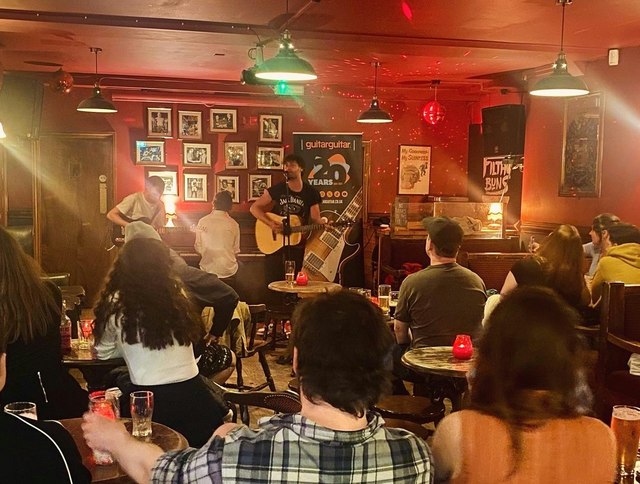
Open Mic At The Three Compasses
Open mic night every 2nd Monday of the month from 7.30pm. We’ll provide a piano, mic, and courtesy of our friends at Guitar Guitar, an electro-acoustic & an electric guitar (I know!) It wouldn’t be a Monday without a drinks offer so our friends at 40FT Brewery are providing pints and house spirit & mixers for only £4.90. On the night, make yourself known to our outrageously charismatic host, Lewis, so he can organise the sets. Everyone will have the chance to perform two ‘turns’ whether that’s a song, poem, spoken word, dancing dogs.... It’s free entry and all performers will receive a discount for Guitar Guitar. Nice. Presented by The Three Compasses. This is an 18+ eventRead more
About Clapton
Clapton refers to both Upper Clapton and Lower Calpton in East London. Upper Clapton is a district in the London Borough of Hackney. It is bounded by the Hackney districts of Stamford Hill to the west, Lower Clapton and Lea Bridge to the south and the Haringey district of South Tottenham to the north. To the east is the River Lea (spelt Lea or Lee), on the other side of which is the expanse of the Walthamstow Marshes, part of which is in the Lee Valley Park. Lower Clapton is immediately adjacent to central Hackney - bounded, roughly, by the western side of Hackney Downs (to the west), the Lea Valley (to the east), Clifden Road (to the south) and the Lea Bridge Road (to the north). Lower Clapton is centred on Lower Clapton Road, to the north of which is Clapton Ponds, the remnant of the old village green.
Find out how much your flat or house is worth in Clapton.
Local estate agencies
How much is your property worth?
Get your property valued by a local expert
Feedback about living in Clapton has been submitted directly by the public and may not necessarily reflect the views of Foxtons. The description of Clapton was modified from Wikipedia and is available under the Creative Commons licence. Land Registry data is Crown copyright. All the views and contributions contained within Foxtons Local Life are those of the contributors. All content is assessed before publishing for taste, however free opinion is encouraged. Foxtons accept no payment or sponsorship for content that is posted about Clapton.