
Haslemere Area Guide
A locals' guide to Haslemere
Where do Haslemere locals go?
Did you know?
"Sir Arthur Conan Doyle loved Surrey and incorporated the setting into many of his novels. He wrote Hound of the Baskervilles whilst living in Hindhead."Explore Haslemere


What locals say about Haslemere
Activities near Haslemere

Haslemere Rock Choir
Are you looking to find a local choir to join? The local Haslemere choir is run by vocal teacher Georgie Standage. The Haslemere branch is part of the unique national singing family that is Rock Choir. Whilst retaining our focus on Haslemere community causes and events, all the local Surrey choirs come together in regional and even national groups for bigger events, such performing en masse at the 10,000 seat Wembley Arena, achieving album sales that enter the charts, nationwide flaskmobs and Guinness World Records and helping to raise millions for charity. Joining this incomparable musical national treasure is very easy, there are no auditions, there's no need to read music and we're open to everyone in your local community! If you find yourself racing through the week with no time for yourself, or struggling to meet new people in Surrey, then joining your local Haslemere choir could be right for you. With our unique, no-pressure approach to teaching and fun, uplifting arrangements of your favorite hit songs Georgie will guide you through your weekly dose of music, fun and laughter. Here is a quote about our choir - 'It's all been said already, but Rock Choir is just the best, most fun and most uplifting experience ever. The more people that join, the happier this country will be. ' - Teresa (Rock Choir member) Rock Choir is a winner of the Red Ribbon 'Big Heart' Award [https://rockchoir.com/awards-achievements/]. and holds 1 former and 2 current Guinness World Records. The choir is also credited with single handedly starting the contemporary choir movement.Read more

Summer Afternoon Concert
An afternoon concert of choral music to suit all tastes Conductor: Robert Lewis Pianist: Robert Patterson 4pm - Concert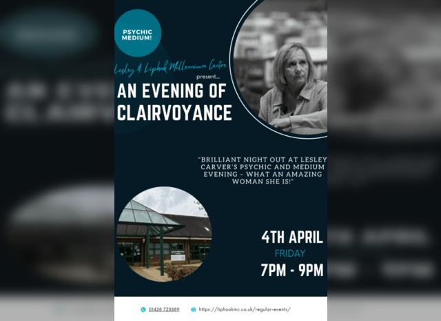
Lesley Carver - An evening of Clairvoyance
As both a gifted medium and spiritual teacher Lesley has become known internationally through her stage shows, one to one readings and psychic classes as well as offering clients the opportunity to call one of her team. Anyone attending one of Lesleys stage shows comes away after a relaxing and fun filled night of entertainment filled with laughter and tears, her unique ability includes being able to bring through spirit of a loved one on the request of an audience participant, to which Lesley humorously delivers her messages with love, caring and sincerity. "I have now been working as a Psychic Medium for 15 years and I continue to meet lovely people and help them to get closure and move on with their lives. Whether the reading is done on a pure Psychic level (including clairvoyance) or medium level, I feel very privileged to be a small part of this process and used as a channel for these messages which give guidance and comfort to clients."Read more
About Haslemere
Haslemere is a town in Surrey, close to the border with both Hampshire and West Sussex. The major road between London and Portsmouth, the A3, lies to the west, and a branch of the River Wey to the south. Haslemere is approximately 12 miles (19 km) south-west of Guildford. Haslemere is surrounded by hills, with Blackdown at 920 feet (280 m) to the south and Gibbet Hill at 894 feet (272 m) to the north. The latter was the site of executions in past centuries. Many of those hanged there were highwaymen, because the roads around Haslemere, particularly alongside the nearby Devil's Punch Bowl, were notoriously dangerous. Today, much of the heathland and woodland is owned and protected by the National Trust, and has become a popular attraction for walkers. The town also marks the western end of the Greensand Way footpath which extends for 110 miles (180 km) to Hamstreet in Kent, and is one end of the Serpent Trail. Haslemere is the most southerly town in Surrey.
Find out how much your flat or house is worth in Haslemere.
Local estate agencies
How much is your property worth?
Get your property valued by a local expert
Feedback about living in Haslemere has been submitted directly by the public and may not necessarily reflect the views of Foxtons. The description of Haslemere was modified from Wikipedia and is available under the Creative Commons licence. Land Registry data is Crown copyright. All the views and contributions contained within Foxtons Local Life are those of the contributors. All content is assessed before publishing for taste, however free opinion is encouraged. Foxtons accept no payment or sponsorship for content that is posted about Haslemere.